BY BRUCE R. CREW
Email: crewbruc@msu.edu
INTRODUCTION
One of the more neglected topics in the field of Biblical Geography
involves the territorial extent of Edom's geographical domain.
Earlier scholars have limited the geographical territories of
Edom exclusively to Southern Transjordan's mountains of Edom (i.e.
Edelman 1995: 2-3; Aharoni 1979: 40-41; Bartlett 1969: 1-20; Gleuck
1936: 152). Its boundaries included an area that lies between
'Wadi el-Hesa in the north, 'Wadi Arabah in the west, 'Wadi Hisma
in the south and Transjordan's basalt desert in the east.
However, recent scholars have challenged this notion. They argue
that the Edom's original territories also included the Negev's
Central Highlands and southern portion (Meshel 2000: 104; 1974:
147-150, xii; MacDonald 1994: 230-246; Rasmussen 1989: 91-92;
Liver 1982: 324-325; Crew 1984: 2-3; 1981: 110-150; Is 1971: 370-371;
Eod-Awd 1963: 622; Cohen 1962: 25). Moreover, two recent archeological
discoveries have provided additional support for this notion.
The first is the discovery of a large system of Israelite forts
and settlements in the Negev's Central Highlands that dates to
David and Solomon's time in the 11th-10th Centuries B.C. (Meshel
2000: 104; Na'aman 1992: 73; 1974: 147-150; xii; Cohen 1979: 61-79).
In particular, excavations at Kadesh Barnea ('Ein el-Quiderat)
and Kuntillet Ajrud reveal a continuous period of Israelite settlement
throughout the period of the Judean monarchy (Meshel 1993a: 1458-1464;
1993b: 1517-1520; Cohen 1983; 1976: 49-50). The second is the
absence of a similar system in southern Transjordan's mountains
of Edom. Archeological surveys from this region further show
that any Israelite settlement occurred between the 9th-7th Centuries
B.C. after which there was a noticeable decline (Na'aman 1992:
73; Bartlett 1992a: 290 ff; MacDonald 1994: 230-246; 1992: 296
ff; Weippert 1979: 29-30).
Thus the notion of an Edom whose geographical territories lay
solely in southern Transjordan is no longer a universal assumption.
Moreover, three OT passages provide additional insight into this
matter. Two of these passages refer to the stationing of Israelite
garrisons in Edom by King David during his reign (2 Sam 8:14;
1 Chr 18:13). The third passage alludes to a flight to Egypt
by Hadad, a member of the Edomite royal family, as a result of
David's military campaign in Edom where his forces under Joab's
command slaughtered every living Edomite male (1 Kgs 11:14-22).
THE 'SELF-CONSISTENCY' APPROACH
Therefore, if the original territories of Edom's geographic
domain lay solely in southern Transjordan, then a serious conflict
exists between these OT passages and the archeological evidence.
In efforts to resolve this conflict, then, it is important to
use an approach that examines ALL of the geographical information
about Edom in Biblical and extra-Biblical texts. Often known
as the 'self-consistency' approach, (Faiman 2000: 115-117; 1994:
90-102; 1986: 209-219), its main premise assumes that some form
of logical continuity must exist for a given topic in Biblical
and extra-Biblical texts. Moreover, this logical continuity displays
a strong pattern of self-consistency in terms of its overall geographical
and historical content.
The 'self-consistency' approach combines what is known as the
'traditional' approach in Judaism with new information from geographical
and archeological explorations (Faiman 1986: 210-211). It assumes
that the geographical and historical information from Biblical
and extra-Biblical texts display problematic difficulties rather
than inherent contradictions for a given topic. Therefore, it
is important to carefully study all references that pertain to
a given topic in Biblical and extra-Biblical texts before drawing
any major conclusions when it comes to the interpretation of the
geographical data so as to develop a complete picture about their
respective contents (Faiman 1994: 91-93).
The 'self-consistency' approach contrasts with what has become
known as the 'non-traditional' approach that has been used in
more recent times Ancient Near Eastern and Biblical geographers
as the main approach to the identification of Biblical sites (Faiman
1986: 211). In using the 'non-traditional approach', its adherents
try to separate what they perceive as a kaleidoscope of different
historical traditions written down at different times by different
people and later edited into a series of contradictory, logically
inconsistent statements by people known as redactors.
However, the primary problem with the 'non-traditional approach'
rests in the fact that as newer and more subsequent knowledge
emerges, any earlier theories are often viewed as obsolete and
then discarded, thus losing any relevancy in relation to a given
question. As a result, the 'non-traditional' approach has led
to a process that has created a constant state of flux in the
construction of logical and coherent theories on the identification
of Biblical sites. According to its main premise, there can be
no degree of consistency or understanding about geographical and
historical information from Biblical and extra-Biblical texts
for any given topic since the conclusions based upon earlier facts
are often invalidated by the individual application of subjective
presuppositions, each with their own interpretation of the geographical
and historical data.
THE IDENTIFICATION OF SEIR WITH EDOM IN BIBLICAL TEXTS
One example of a case where the 'self-consistency' approach
can be applied to Biblical texts for answers to the identification
of Biblical sites involves passages that provide geographical
information on the location of Edom's geographical domain in the
hill country of Seir (Gen. 36:20-21; Num 24:18; Deut 2:1-12; Judg
5:4; 1 Chr 1:38-43; 2 Chr 25:11,14; Ezk 25:8,12-14). A number
of these passages in Biblical texts equate Seir and Edom with
place-names that are synonymous with one another (Gen 32:3; 36:6-9).
Therefore, the passages suggest that Seir and Edom comprise an
entity should be viewed as one and the same in terms of their
respective geographical locations.
However, in using the 'non-traditional' approach to this question,
J.R. Bartlett (1992a: 287-295; 1992b: 13-19; 1969: 3-5) rejects
Seir's equation with Edom. Bartlett contends that Seir and Edom
comprise two different geographical entities that lay at separate
locations. The hill country of Seir existed in the Negev's Central
Highlands while the territory known as Edom was confined to southern
Transjordan's mountains of Edom. Bartlett further argues that
Seir's identification with Edom resulted from later additions
to Biblical texts that were made by a redactor sometime after
the Edomites migrated into the Negev's Central Highlands between
the 8th-6th Centuries B.C.
However, in contrast to Bartlett's use of the 'non-traditional
approach for this question, the 'self-consistency' approach permits
the gleaning of additional geographical information from other
Biblical passages on Edom's original geographical domain (Gen
36:20-21; Deut 1:12, 22; 1Chr 1:38-43). This additional information
shows that the use of Seir as a geographic place-name resulted
from the earlier settlement of the Negev's Central Highlands by
a prominent family who came from a group of people known as the
Horites (Deut 1:12, 22). Following the Edomites' migration into
the region, they expelled the Horites from their former homeland
and changed the name of the Horites' former homeland to Edom (Edelman
1995: 9-10). As a result, the newer place-name Edom became a
permanent fixture as its new occupants remained in the region
over a longer period of time.
OTHER REFERENCES TO EDOM IN BIBLICAL AND NON-BIBLICAL TEXTS
The use of the 'self-consistency' approach to the location
of Edom's geographical domain further helps to resolve other problematic
difficulties in Biblical and extra-Biblical texts on the location
of the original territories of Edom's geographical domain. A
military campaign against the Horites in the hill country of Seir
by a group of Mesopotamian kings makes logical sense if the original
territories of Edom's geographical domain included the Negev's
Central Highlands and southern portion (Gen 14:6-7). However,
if Edom's original territories were limited solely to southern
Transjordan, then it requires the re-location of Kadesh Barnea
(earlier known as En-Mispat) in order to provide a proper geographical
setting for this passage. This relocation is untenable in light
of Kadesh Barnea's long-established identification at 'Ein el-Quiderat'
somewhere along the western edge of the Negev's Central Highlands.
Moreover, the Wilderness of Paran lies within the central portion
of the Negev as opposed to southern Transjordan's mountains of
Edom. It reaches originate from deep within the Sinai Peninsula
before draining eastward into 'Wadi Arabah (Edelman 1995: 9; Baly
1974: 247-248; Karmon 1971: 287; Orni and Efrat 1966: 15, 20).
The Simeonite campaign against a remnant band of the Amalekites
at Mt. Seir also encounters problems if the original territories
of Edom's geographic domain were limited solely to southern Transjordan
(1 Chr 4:42-43). This would have placed the Simeonites' tribal
allotment a considerable distance away from the Negev's northwest
portion, part of an area that belongs to the Biblical Negev and
exists in closer proximity to the Negev's Central Highlands (Rainey
1984: 100-101). It is highly unlikely that the Simeonites would
have gone to so much trouble to eliminate a small Amalakite band
living in southern Transjordan's mountains of Edom because it
would have posed no immediate military threat to the Simeonites.
In addition, the Judahite clans who lived in the Biblical Negev
would have provided a solid buffer zone against any attack from
this remmant of the Amalakites.
A 14th Century B.C. reference from the El-Amarna letters (No.
288) further mentions the loss of Egyptian control over an area
in the land of Canaan that extended from the sites of Gath-Carmel
in the north to Mt. Seir in the south (Prichard 1955: 488). The
geographical setting for this El-Amarna letter suggests that Mt.
Seir's location lay somewhere in the vicinity of southwestern
Canaan in closer proximity to Egypt as opposed to southern Transjordan's
mountains of Edom (MacDonald 1994: 231-233). Moreover, the appearance
of Mt. Seir in this El-Amarna Letter occurs in connection with
several known cities and towns of Canaan's southern Coastal Plain
and western Shephelah regions but contains no reference whatsoever
to cities and towns located in southern Transjordan's mountains
of Edom (Edelman 1995: 9). That represents a rather strange coincidence
if Mt. Seir's location lay solely in southern Transjordan rather
than the Negev's Central Highlands.
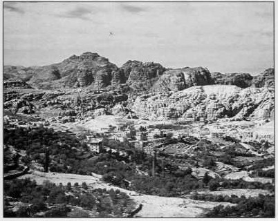 |
Jebel Harun: The most prominent mountain in the area of Petra (Jordan) is Jebel-Harun (The Mountain of Aaron). Josephus identified this mountain as the burial place of Aaron. However, the Bible places Mt. Hor on the border of Edom close to Kadesh Barnea (Nm. 20-22-28; Dt. 32:50) |
A Biblical passage from the Israelite Exodus and Wilderness Wanderings
also places the location of Kadesh Barnea right on the border
with Edom (Num 20:16). The passage states that Moses dispatched
messengers to the king of Edom from this location to request safe
passage for the Israelites along a road known as the 'King's Highway'.
If Edom's original territories were limited to southern Transjordan's
mountains of Edom, then the Israelite messengers would have had
to traverse the entire east-west length of the Negev's Central
Highlands in order to meet with the king of Edom. This possible
scenario conflicts directly with the geographic information contained
in this passage.
In addition, there are only three-four references to the title
of the King's Highway in Biblical texts, all of which are associated
with the Israelites' request for safe passage through non-Israelite
territorial domains (Num 20:17, 19; 21:22; Deut 2:27). Yet this
title is strangely absent from other ancient sources that pertain
to the history of kingdom and city-states that lay in southern
Transjordan. It is also important to note that the route passing
through the Negev that connects the site of Kadesh Barnea to 'Wadi
Arabah is known in Arabic as the 'Darb es- Sultan', which literally
means 'Way of the King' (Glueck 1959: 228-229). Recent studies
have shown that this title was used as an appelative to designate
a public or high road in antiquity, a phenomenon that appears
in Aramaic and Akkadian sources during Assyrian times (Weippert
1979: 23; Obed 1970: 182). Thus the title that is displayed in
these Biblical passages could have easily denoted the ancient
route that crossed the east-west length of the Negev's Central
Highlands, as well as the north-south route that traverses Transjordan's
eastern highlands (Rasmussen 1989: 91-92, 242).
Furthermore, Biblical texts state that the burial place of Moses'
brother Aaron lay at Mt. Hor right along the border with Edom
somewhere in the immediate vicinity of Kadesh Barnea (Num 20:22,
23; 33:37-39). The passages state that Mt. Hor comprised the
first location at which the Israelites camped following their
departure from Kadesh Barnea. The writings of Flavius Josephus
place Mt. Hor in southern Transjordan's mountains of Edom at a
location traditionally identified with Jebel Harun's twin peaks
(Antiquities IV.4.7, hereafter noted as Antiq. in
the Loeb Classical Library). However, the later writings
of Josephus are viewed as being in error whenever they conflict
with information from earlier historical sources such as Biblical
texts (Roth 1992: 287).
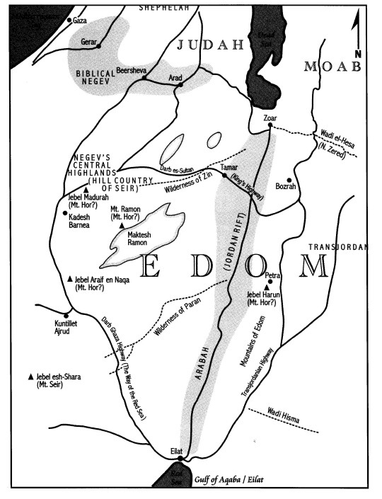
If the site of Kadesh Barnea exists at 'Ein el-Quiderat along
Negev's Central Highlands' western edge, though, then it makes
logical sense to place Mt. Hor somewhere in its immediate vicinity.
There are a number of suitable candidates that exist in closer
proximity to 'Ein el-Quiderat as compared with Jebel Harun's twin
peaks in terms of prospective sites for Mt. Hor. These include
Jebel Madurah or 'Inaret el-Khoreisheh (Cleave 1994: 212; Roth
1992: 287; Rasmussen 1989: 91; Aharoni 1979: 202, 436), Jebel
'Araif en Naqa (Faiman 1986: 213-214), and Mt. Ramon (Har-El 1983:
430).
Moreover, the description of the ancient boundaries between Israel
and Edom further state that the kingdom of Edom bordered Israel
on the south rather than the east according to the geographical
information found in Biblical texts (Num 34:3-5; Josh 15:1-4,
21-32). The border began at the Dead Sea's southern tip, moved
up the Ascent of Akrabbim and then turned westward. It passed
through the Wilderness of Zin and touched the sites of Hazzaraddar,
Azman and Kadesh Barnea before reaching the Brook of Egypt, a
landmark commonly associated with 'Wadi el-Arish. From these
border descriptions in Biblical texts, it is clear that the boundary
between passed through the Negev's Central Highlands but barely
touched southern Transjordan's mountains of Edom to the east (Aharoni
1979: 67-72).
The OT passages alluding to David's conquest of Edom have already
been mentioned earlier in this article (i.e. 2 Sam 8:14; 1 Kgs
11:14-22; 1 Chr 18:13). The system of Israelite forts and settlements
discovered in the Negev's Central Highlands displays at least
45 different sites that can fit anywhere from two-four different
classifications according to size, layout and function (Finkelstein
1989: 189; Cohen 1979: 61-78). Moreover, a large number of these
sites display wheel-made Israelite pottery, a type that strongly
resembles characteristics common to ceramic ware found at other
locations in ancient Israel (northern, southern), including the
Biblical Negev, during this period of archeological settlement
(Herzog 1983:41; Cohen 1979:61-78). A large number of these
Israelite forts and settlements also contain agricultural installations
that entailed the farming of dry wadi beds in the Negev's Central
Highlands via a form of desert agriculture known as 'runoff farming'
(Evenari, Shanon and Tadmor 1982; Cohen 1979:61-78).
In addition, it is important to note that this line of forts and
settlements along the eastern edge of the Negev's Central Highlands
bears a striking resemblance to the border descriptions as displayed
in Biblical texts between the southern Israelite tribe of Judah
and Edom (Cohen 1979: 77-78). The nature of these forts and settlements
further suggests that they possessed some form of sedentary capabilities,
although the exact degree and extent remains the subject of intense
debate (Finkelstein and Perevolotsky 1990: 67-88; 1989: 189-201;
Crew 1981: 103-108; Cohen 1979: 61-78). These forts and settlements
in the Negev's Central Highlands could have also been manned by
tribes who were loyal to the ancient Israelites and had inhabited
the Biblical Negev since earlier times (i.e. Simeonites, Judahite
clans). Their semi-nomadic lifestyle and loyalty to the United
Monarchy would have enabled them to quickly adapt to life as soldier-farmers
in a desert environment (1 Sam 27:6-12). Moreover, incentives
from the United Monarchy could have induced individuals of these
groups to settle in the Negev's Central Highlands, particularly
along Israel's southern border with Edom.
If the Negev's Central Highlands and southern portion are included
in the original territories of Edom's geographical domain, then
an ensuing harmony occurs between the geographical information
contained in these passages and the available archeological evidence.
In addition, it would provide a vital clue as to why the Israelites
under David and Solomon would have gone to so much trouble to
construct a large system of forts and settlements in the Negev's
Central Highlands (Na'aman 1992: 73-74). These forts and settlements
would have been needed to subdue an Edomite population that was
hostile to the Israelites, as well as protect the trade routes
that passed through the Negev before linking up with other land
routes to the Orient via the Arabian Peninsula.
|
|
|
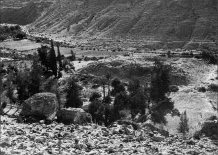
Aerial View of Ein el-Qudeira, identified by most scholars as Kadesh Barnea |
|
|
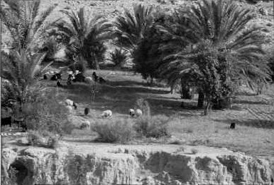
Green Pastures: The Oasis at Kadesh Barnea |
REFERENCES TO EDOM IN JOSEPHUS
The 1st Century writings of Flavius Josephus also provide an
additional source of geographical information on the extent of
the original territories in Edom's geographical domain. Josephus
writes that Esau first lived in the hill country of Seir following
his departure from Hebron, an Isrealite town located in the Judean
hill country's southern portion (Antiq. IV:2:1-3). According
to Biblical texts, Essau was the first son of Issac who later
became the founding father of the Edomites (Gen 36:9). However,
by the time of Josephus, the area formerly known as the hill country
of Seir now belonged to a people known as the Idumaeans, or remaining
Edomite remnant. Josephus further mentions in another passage
that the prophet Elijah passed through the town of Beersheba during
his flight from Jezebel (Antiq. VIII.13.7). Josephus states
that the town of Beersheba comprised the southernmost town that
belonged to the Israelite tribe of Judah, whose territory now
lay right on the border of a country that belonged to the Idumaeans.
Finally, in a third passage, Josephus refers to the location
where the Israelites under Moses leadership had first tried to
enter the land of Canaan from the south as an area of land that
now bordered the country belonging to the Idumaeans or former
Edomite remmant (Antiq. IV.4.5).
While the information on earlier Biblical events found in Josephus
does not always match the descriptions for these same historical
events from Biblical texts, nevertheless one thing is perfectly
clear. The geographical information contained in the writings
of Josephus that pertains to Seir and Edom (Idumaea) location
remains consistent with a geographical setting in which the original
territories of Edom's geographical domain must have included the
Negev's Central Highlands and southern portion. Thus Josephus
preserves the geographical context found in Biblical texts which
depict an Edom whose original territories were not limited solely
to southern Transjordan.
CONCLUSIONS
Through the use of the 'self-sufficiency approach', then, it
is possible to conclude that the geographical information contained
in Biblical and extra-Biblical texts overwhelmingly support the
inclusion of the Negev's Central Highlands and southern portion
into the original territories of Edom's geographical domain.
The geographical and historical details that appear in ALL
of those references that pertain to Edom in Biblical and extra-Biblical
texts displays a pattern that is too self-consistent to have otherwise
been the case. Such a conclusion would also explain the appearance
of Seir and Edom together in passages such as Deut 33:2 and Judg
5:4, whose geographical setting fits a context other than the
Arabian Peninsula (Heiser 1998: 1-11). The appearances of Seir
and Edom in conjunction with Mt. Paran and Mt. Sinai in these
two passages also provide a single and coherent geographical unit
that is better suited to the Negev-Sinai region. Thus the location
of Mt. Sinai somewhere in the Sinai Peninsula's western-central
portion is totally consistent with the inclusion of the Negev's
Central Highlands and southern portions into the original territories
of Edom's geographical domain (Franz 2000: 101-113; Faiman 2000:115-118;
Rasmussen 1989: 88-90; Har-El 1983: 242-275)
Finally, all of these conclusions are consistent with the data
that has been compiled as a result of geographical and archeological
research during the past 30-40 years in the Negev's Central Highlands
and southern portion, together with southern Transjordan's mountains
of Edom. Moreover, the inclusion of the Negev's Central Highlands
and southern portion in the original territories of Edom's geographic
domain provides a clue as to the identity of the earlier EBIV-MBI
inhabitants in the Negev's Central Highlands. Biblical texts state
that prior to the settlement of the Edomites in the hill country
of Seir, the Horites inhabited the region (Deut 2:12). No other
ancient sources (Biblical or extra-Biblical) provide even the
slightest hint as to the identity of these earlier inhabitants
for the Negev's Central Highlands and southern portion.
The later appearance of the Nabateans in the Ancient Near East
is also easier to understand when their ascendance is viewed in
the context of an Edomite geographical domain whose original territories
included the Negev's Central Highlands and southern portion1.
The location of the Nabateans' former homeland in the Arabian
Peninsula's northwest portion would have placed them in an ideal
position from which they could have taken control of those territories
that formerly comprised ancient Edom prior to its destruction
by Nebuchadnezzar (Bartlett 1979: 64-66). The Nabateans could
have easily exploited the resulting political and cultural chaos
in order to acquire supremacy over all of the other Ancient Near
Eastern nomadic tribes. More than anything else, it was the Nabateans'
control of the trade routes that connected their capital at Petra
in southern Transjordan with the Mediterranean port at Gaza via
the Negev's Central Highlands that provided them with their wealth
and prestige as a geo-political power in the Ancient Near East.
On the other hand, the surviving Edomite remnant migrated into
the Biblical Negev and southern portion of the Judean hill country
following Edom's destruction by Nebuchadnezzar. This Edomite
remnant later became known as the Idumeans, who were incorporated
into neighboring Judea during the 2nd Century B.C. following their
conquest by John Hyrcanus I (Edelman 1995: 5). It is only against
this geographical and historical backdrop that the Nabateans'
subsequent ascendance and control of the Negev's Central Highlands,
together with its southern portion, can best be understood.
FOOTNOTES
1 The Nabateans' ascendance as a geo-political power in the Negev and Ancient Near East is a subject that must be left for a future article. In particular, the role of the geographical-historical setting of the Nabateans in fostering the birth of early Christianity comprises a noteworthy topic.
BIBLIOGRAPHY
Aharoni, Y.
1979 The Land of the Bible: A Historical Geography, 3rd
edition. Translated from the Hebrew by A.F. Rainey. Philadelphia:
Westminister.
1993 The MacMillan Bible Atlas, 3rd edition, ed. By Anson
F. Rainey and Ze'ev Safrai. New York/Toronto: MacMillan.
Baly, D.
1974 The Geography of the Bible. New York: Harper
and Row.
Bartlett, J.R.
1969 The Land of Seir and the Brotherhood of Edom. Journal
of Theological Studies 20: 1-20.
1979 From Edomites to Nabateans: A Study in Continuity. Palestine
Exploration Quarterly 111: 53-66.
1992aEdom. The Anchor Bible Dictionary. Vol II, pp 287-295.
1992bBiblical Sources for the Early Iron Age in Edom. Pp. 13-19
in Early Edom and Moab: The Beginning of the Iron Age in Southern
Jordan, ed. Piotr Bienkowski. Sheffield: J.R. Collis.
Cleave, R.
1994 Satellite Atlas of the Holy Land, Vol. I. Bangkok:
Rohr Productions.
Cohen, R.
1976 Excavations at Horvat Haluqim. Antiqot XI: 49-50.
1979 The Iron Age Fortresses in the Central Negev. Bulletin
of the American Schools of Oriental Research 236: 61-79.
1983 Kadesh Barnea. Jerusalem, Israel Museum.
Cohen, S.
1962 Edom. Interpreter's Dictionary of the Bible,
pp. 24-26 in Vol. 2, ed. G.A. Buttrrick. New York: Abingdon.
Crew, B.R.
1981 A Geo-Political History of the Negev and its Role
in Possible Jewish Contributions to the Area's Runoff Agriculture:
Israelite through Nabatean Times. M.A. Thesis, Jerusalem
University College, Jerusalem.
1984 The Negev as Part of the Territories of Edom. Biblical
Geographical Newsletter (Association of American Geographers)
4: 2-3.
Edelman, D.V.
1995 Edom: A Historical Geography. Pp. 1-11 in You Shall
Not Abhor An Edomite For He Is Your Brother: Edom and Seir in
History and Tradition, ed. Diana Vikander Edelman. Atlanta:
Scholars Press.
Eod-Awd, B.
1963 Edomites. Encylopedic Dictionary of the Bible,
Cols. 521-524, ed. and trans. I.F. Hartman. New York: McGraw-Hill.
Evenari, M., Shanan L., and Tadmor N.
1982 The Negev: Challenge of a Desert, 2nd edition
(1st in 1971). Cambridge: Harvard University.
Faiman, D.
1986 The Route of the Exodus. Dor le Dor 14/4: 209-219.
1994 From Horeb to Kadesh in Eleven Days. Jewish Bible Quarterly
22/2: 91-102.
2000 Digging Mount Sinai from the Bible. Bible and Spade
13/4: 115-117.
Finkelstein, I.
1989 The Iron Age "Fortresses" of the Negev Highlands:
Sedentarization of the Nomads. Tel Aviv Journal 11/2:
189-207.
Finkelstein, I. and Perevolotsky, A.
1990 Processes of Sedentarization and Nomadization of Sinai
and the Negev. Bulletin of the American Schools of Oriental
Research 279: 67-88.
Franz, G.
2000 Is Mount Sinai in Saudi Arabia? Bible and Spade
13/4: 101-113.
Gleuck, N.
1959 Rivers in the Desert. New York: Grove.
1936 The Boundaries of Edom. Hebrew Union College Annual
11: 141-159.
Har-El, M.
1983 The Sinai Journeys: The Route of the Exodus.
San Diego: Ridgefield.
Heiser, M.S.
1998 Mount Sinai in Arabia. Paper presented at the
annual meeting of the Near Eastern Archeological Society, Orlando,
FL.
Herzog, Z.
1983 Enclosed Settlements in the Negeb and the Wilderness
of Beersheba. Bulletin of the American Schools of Oriental
Research 250: 41-49.
Is, A.
1971 Edom. Encylopedia Judaica, Vol. 6, Cols. 369-375.
Josephus, F.
1988 Jewish Antiquities (The Loeb Classical Library).
Trans. H.J. Thackery and R.Marcus from Greek, 1st ed. 1920.
Cambridge Mass.: Harvard.
Karmon, Y.
1971 Israel: A Regional Geography. London/New York:
Wiley Interscience.
Liver, H.
1982 Seir. Encylopaedia Biblica 8, pp. 323-325, Jerusalem
(HEBREW).
MacDonald, B.
1992 Edom. The Anchor Bible Dictionary, Vol. II, pp.
287-295.
1994 Early Edom: The Relation between the Literary and Archeological
Evidence. Pp. 230-246 in Scripture and Other Artifacts: Essays
on the Bible and Archaeology in Honor of Philip J. King, ed.
Michael D. Coogan, J. Cherryl Exum and Lawrence E. Stager. Louisville:
John Knox.
Meshel, Z.
1974 History of the Negev at the Times of the Kings of
Judah. Ph.D. Dissertation, Tel Aviv University, Tel Aviv.
(HEBREW with English summary, pp. I-XIV).
1993aTeman Horvot. The New Encylopedia of Archeological
Excavations in the Holy Land
4:1458-1464.
1993bYotvata. The New Encylopedia of Archeological Excavations
in the Holy Land
4: 1517-1520.
2000 The History of The Darb Ghaza-The Ancient Road to Eliat and
Southern Sinai. Pp. 99-117 in Sinai: Excavations and Studies,
BAR Series 876. Oxford: Archaeopress/Basingstoke.
Murakami, M.
1995 Managing water for peace in the Middle East : Alternative
Strategies. Tokyo/New York : United Nations University Press.
Na'aman, N.
1992 Israel, Edom and Egypt n the 10th Century B.C.E. Tel
Aviv Journal 19: 71-93.
Obed, B.
1970 Observations on Methods of Assyrian Rule in Transjordania
after the Palestinian Campaign of Tiglath Pileser III. Journal
of Near Eastern Studies 29: 177-186.
Orni, E. and Ephrat, E.
1966 Geography of Israel. Jerusalem: Israel Universities.
Prichard, J.B.
1955 Ancient Near Eastern Texts. Princeton: Princeton
University Press.
Rainey, A.F.
1984 Early Historical Geography of the Negeb. Pp. 88-104
in Beer-Sheba II: The Early Iron Age Settlements, ed. Ze'ev
Herzog. Tel Aviv: The Institute of Archaeology and Ramot Publishing.
Rasmussen, C.G.
1989 NIV Atlas of the Bible. Grand Rapids: Zondervan.
Roth, R.L.
1992 Hor. The Anchor Bible Dictionary, Vol. III, pp.
287.
Weippert, M.
1979 The Israelite Evidence from Transjordan. Pp. 15-34 in
Symposium Celebrating the Seventy-Fifth Anniversary of the
American Schools of Oriental Research, ed. F.M. Cross Jr.
Cambridge (Mass.): American Schools of Oriental Research.
Posted 3/14/03.